
The SGV Collaborative Regional Recovery Hub Mini Data Story
Published on August 3, 2026
The San Gabriel Valley, located on the eastern side of Los Angeles County between Pasadena and Pomona, is one of the most diverse regions in the country. However, one thing that all residents have in common is bearing a disproportionate environmental burden. This community is threatened across multiple environmental dimensions including extreme heat, poor air quality, and pollution, much of which is unfortunately a result of intentional choices.
Since 2022, the non-profit ActiveSGV has been leading the SGV Collaborative, a coalition of other local non-profits, as part of a Regional Recovery Hub funded by the California Community Foundation to address some of this environmental injustice. A data story was previously written on the work of the SGV Collaborative in 2024. This data story will focus on the environmental burden in the SGV Collaborative’s focus area and how it impacts other aspects of residents’ lives including housing, social connectedness, and health. Responses from a survey of residents conducted by SGV Collaborative member organizations are also included throughout.
NDSC gathers data on this area from various government sources, survey results, and our own research. The results of our analysis are provided to partners like the SGV Collaborative and are also made available to all via tools like our free interactive map, which can show specific details for specific neighborhoods, as seen below.
Background
For generations, San Gabriel Valley residents have lived in the shadow of two persistent environmental hazards, each still extracting a toll on community health today. The first is contaminated groundwater. Improper disposal of harmful contaminants and toxic chemicals from decades of heavy industrial development during the mid-to-late 1900s in the San Gabriel Valley has led to severe human health effects. In 1979, widespread volatile organic compound (VOC) contamination was found in the San Gabriel Water Basin, impacting over one million residents who rely on this 30 square miles of groundwater to this day.
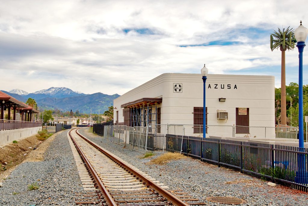
In addition to groundwater contamination, the San Gabriel Valley is home to EcoBat, formerly known as Quemetco, which is a lead battery recycling facility operating on an expired permit that has been accused of improper disposal of toxic waste. EcoBat melts down 600 tons of battery and scrap every day, and any amount of airborne lead particles is considered unsafe for humans. High levels of lead were found in soil on some surrounding properties.
More recently, residents of the San Gabriel Valley have experienced adverse environmental effects resulting from a 2,400 gallon oil spill in East Los Angeles in May as well as a massive cold storage warehouse fire in Boyle Heights in June that burned for days and prompted air quality alerts and a state of emergency.
Environmental Burden
Traffic, Pollution, and Air Quality
Much of the San Gabriel Valley is impacted by heavy traffic due to the high volume of drivers. Naturally, the traffic impacts are especially heightened along the I-10, I-210 (Foothill Freeway), and SR-60 (Pomona Freeway) corridors. These interstates have some of the highest traffic density in the entire state. Exacerbating the issue is the growth of the busiest ports in the nation, those in Los Angeles and Long Beach. The SGV’s freeways are critical arteries connecting the ports to warehouses in the Inland Empire, leading to increasing diesel truck traffic through the area. Multiple respondents of the ActiveSGV survey noted that “less traffic” would make the San Gabriel Valley better in the immediate term, especially as it pertains to improving safety for bicyclists and walkers.

Pollution burden is defined by CalEnviroScreen as an aggregate measure of an area’s exposure indicators to different types of pollution (i.e., air and water quality) and environmental effects based on locations of toxic chemicals. As of 2021, this region’s pollution burden is in the 57th percentile, or worse than well over half of Los Angeles County census tracts.
Poor air quality, which is measured by the annual concentration of particulate matter 2.5 (PM2.5) that typically comes from cars, trucks, industrial processes, or other burning processes, is another challenge faced by constituents of this region. As of 2021, the area has worse air quality than nearly two-thirds of Los Angeles County census tracts. Within this region, Pomona and San Dimas rank among the bottom 10% of neighborhoods for air quality, as is shown on the map below.

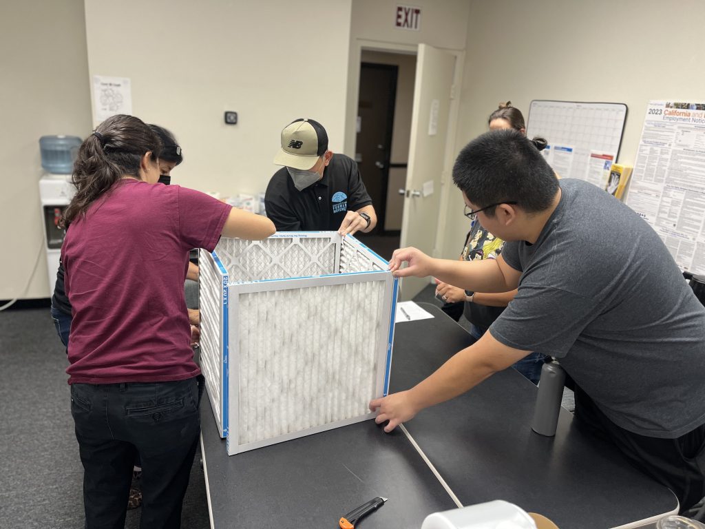
From the SGV Collaborative, API Forward Movement has worked with residents and youth to identify air quality concerns, collect local data by deploying low-cost air sensors, participate in research to study the efficacy of DIY air filters, and advocate for policy solutions. NDSC tools can point out the areas of most need and help focus resources.
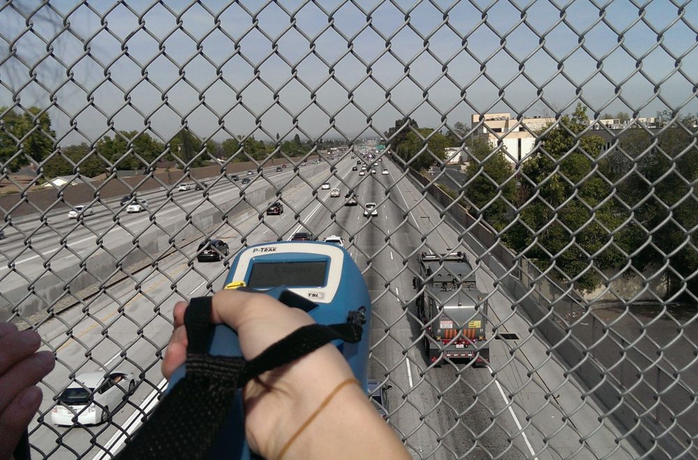
Currently, this region is heavily reliant on cars. A large majority of residents commute primarily by driving alone, as is evident on the commute mode map below. These data are corroborated by the SGV Collaborative’s survey responses, in which over 68% of people said that driving alone is how they typically get around. Public transit usage remains relatively low, with a majority of survey respondents reporting never using public transit in the SGV or using it only 1-2 times a year. In addition to more convenient bus connections and improved timeliness and frequency, the most popular answer to the question “What would help you use public transit more often?” was safe walking routes.

ActiveSGV has pushed to reduce reliance on cars altogether by building more bikeable and walkable infrastructure, alongside vouchers for e-bikes. For those who do still need a car, the group has encouraged buyers to switch to electric vehicles, which would alleviate pollution.
Green Coverage/Shade
Though this region has a similar percentage of green coverage as the rest of the county, at around 20%, this coverage varies significantly between the northern areas and the central and southern areas. If the northern areas of Pasadena and Altadena, which are closest to the mountains, are not included, the green coverage rate of the region drops to 15%. Green coverage is important for providing shade, cooling, and other environmental benefits. In the SGV Collaborative’s survey, residents most commonly selected “shade and trees” as an intervention that would make public spaces more comfortable and accessible. In response to the question, “What would make the San Gabriel Valley better now?” a number of respondents also mentioned trees, shade, and green spaces.
“More shade would be nice, it gets really hot in the SGV during the summer. If they add more trees throughout the SGV it would be cooler all around.”
San Gabriel Valley resident and survey respondent
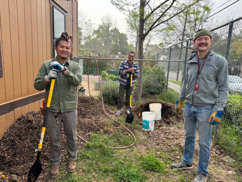
To address this, Sustainable Claremont organizes drought-tolerant tree giveaways, including in Altadena after the 2025 fires. Nature for All supports investments to expand urban tree canopy, increase shade, and connect communities to parks and trails. API Forward Movement is coordinating with several other non-profits to plant between 30 to 60 trees and replace asphalt with greenspace at Fremont Elementary School, directly adjacent to the I-10. ActiveSGV secured $6 million for the El Monte City School District to replace asphalt with greenspace and, in the future, create the region’s first micro-forest. The group also wants to turn a decommissioned school into a park.
Heat Wave Risk
Green coverage is especially important for this region due to the high heat wave risk. According to the FEMA National Risk Index, the whole San Gabriel Valley region is either high risk or highest risk for heat waves. This means that the San Gabriel Valley is likely to have more frequent and intense extreme heat days and residents are at higher risk of heat-related illness and mortality. These adverse health effects can include heat exhaustion, stroke, and worsening chronic conditions like cardiovascular disease. Extreme heat also puts greater strain on energy systems used to cool buildings. This heat wave risk underscores the need for shade, cooling centers, and quality housing. Currently in the SGV Collaborative’s region, three out of four housing units were built in 1979 or earlier, and homes of that age were not built to withstand today’s extreme heat.

Day One provides heat awareness education and connects residents to cooling assistance programs, using NDSC data to identify where needs are greatest and tailor outreach efforts.
Seeking Environmental Justice
This community is threatened across multiple environmental dimensions including pollution, air quality, and heat. Much of this environmental burden has been built up over decades due to a lack of environmental regulation or action regarding harmful effects of industrial production. Residents know this history of environmental injustice and they are demanding better. Many survey respondents noted wanting more protected bike lanes, and greater access to public transit and affordable housing in order to make the San Gabriel Valley a desirable and accessible place for the next generation.
“Studies have shown that access to transportation is one of the most efficient ways to get out of poverty. E-bike programs + protected bike lanes + access to third-spaces will alleviate much of the pain points. The next generation will benefit from tree plantings and bike infrastructure placed today.”
San Gabriel Valley resident and survey respondent
The SGV Collaborative has made significant progress towards a more sustainable and resilient San Gabriel Valley and continues to advocate for increased access to services and resources so that all can enjoy a healthy and inclusive lifestyle in this region. Member organizations include Active SGV, Asian Pacific Islander Forward Movement, Asian Youth Center, Day One, Healing & Justice Center, Nature for All, LA Forward, Latino & Latina Roundtable, and Sustainable Claremont.
Authors

Emily Desmond
Emily is a first-year Master of Public Administration student at the Price School. She is passionate about understanding how cities function to tackle complex civic challenges and make urban systems work better for people. For the past two years, Emily has been focused on state and local solutions to the housing crisis through work at the Nowak Metro Finance Lab, the National Housing Crisis Task Force, and the California Community Foundation. In these roles, she conducted qualitative and quantitative research to elevate innovative practices and develop frameworks to scale these interventions to more places across the country.

Nicholas Werner
Nicholas Werner is an MPP student at the USC Price School of Public Policy. He has been a writer and editor in the private sector for over 15 years, returning to school now to build out quantitative and analytical skills. On the side, he writes articles about aerospace.
Sources
Dugdale, E. E. (2026, June 18). Here’s what we know about the Lineage warehouse fire. Los Angeles Public Press. Link
Fox 11 Los Angeles. (2026, May 22). Ruptured underground pipeline dumps about 2,400 gallons of crude oil into LA River. Link
Peterson, M. (2024, April 22). California communities are fighting the last battery recycling plant in the West — and its toxic legacy. Grist. Link
Upper San Gabriel Valley Municipal Water District. (n.d.). Water Quality. Link