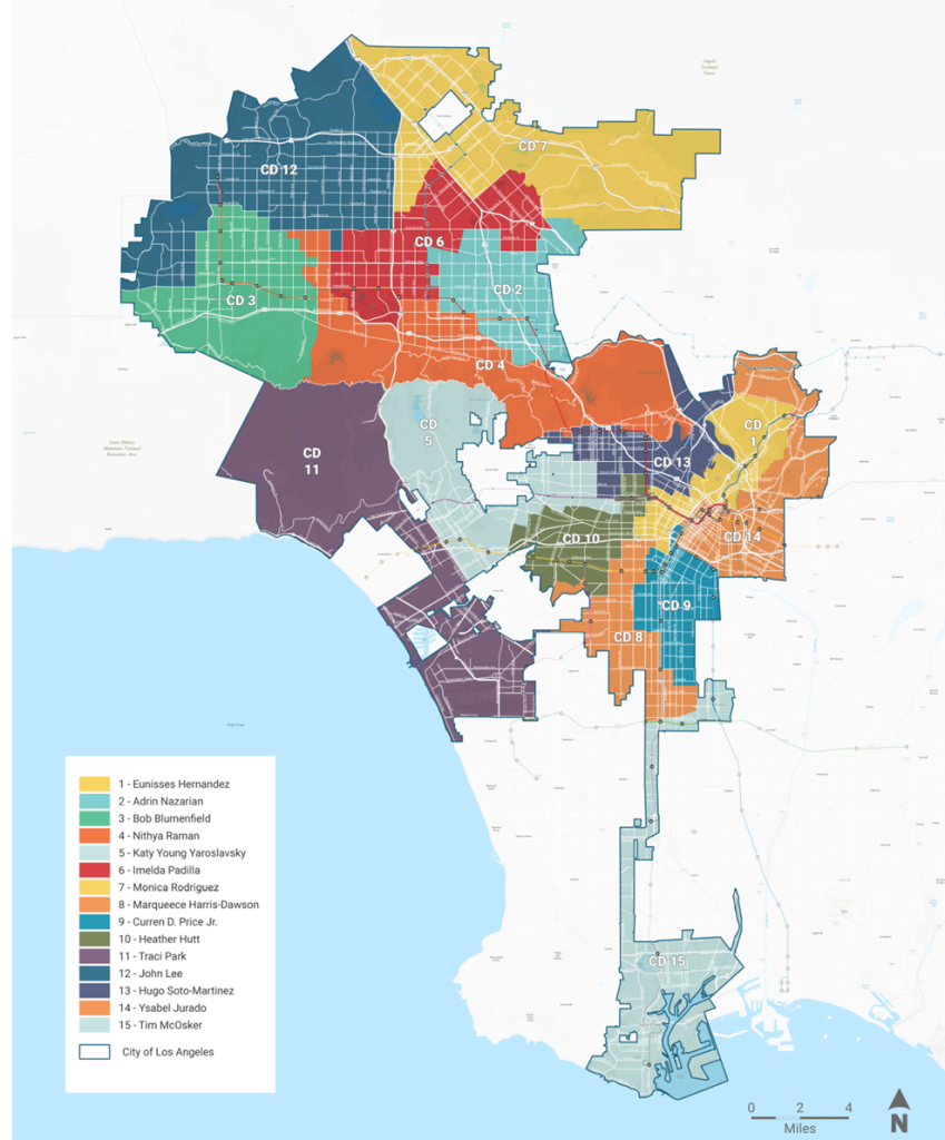
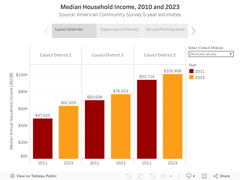
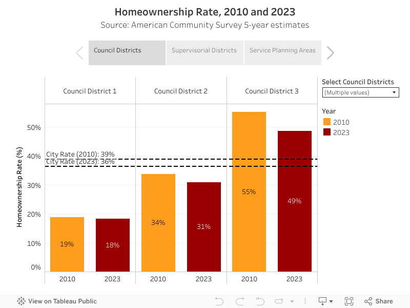
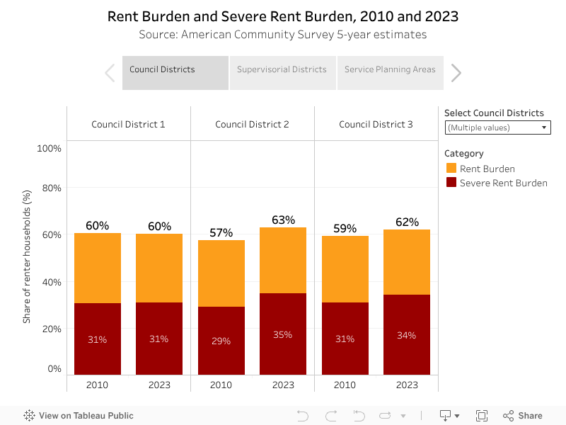
The Los Angeles City Council is a nonpartisan, lawmaking body for the city of Los Angeles. Council members are elected every four years and council boundaries are redistricted every ten years based on the decennial census. There are 15 Council Districts.
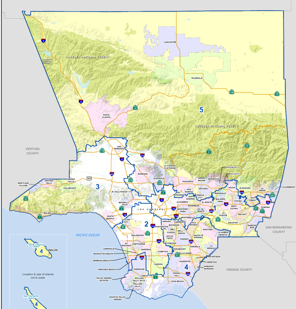
Supervisorial Districts
The Los Angeles County Board of Supervisors is a nonpartisan, lawmaking body for the county of Los Angeles. Supervisors are elected to four-year terms. There are currently 5 Supervisors, but a successful 2024 ballot measure approved the election of a nine-member board of supervisors by 2032.
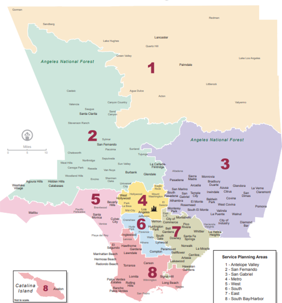
Service Planning Areas
Service Planning Areas (SPAs) are geographic regions defined by the Department of Public Health to develop and provide more relevant public health and clinical services targeted to the specific health needs of the residents in these different areas. There are 8 Service Planning Areas.
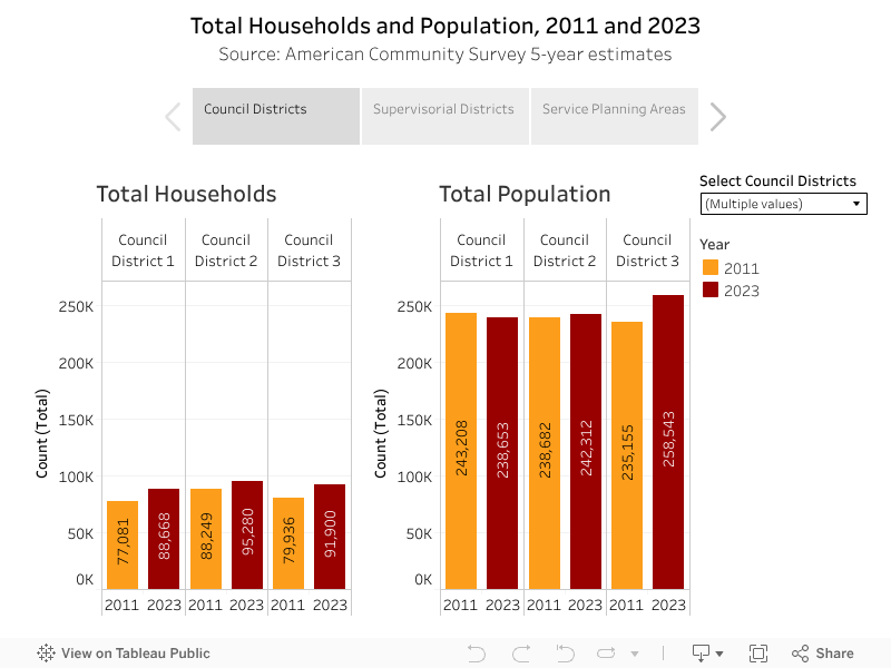
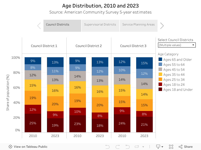
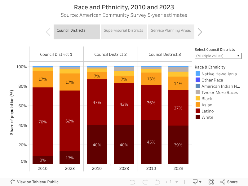
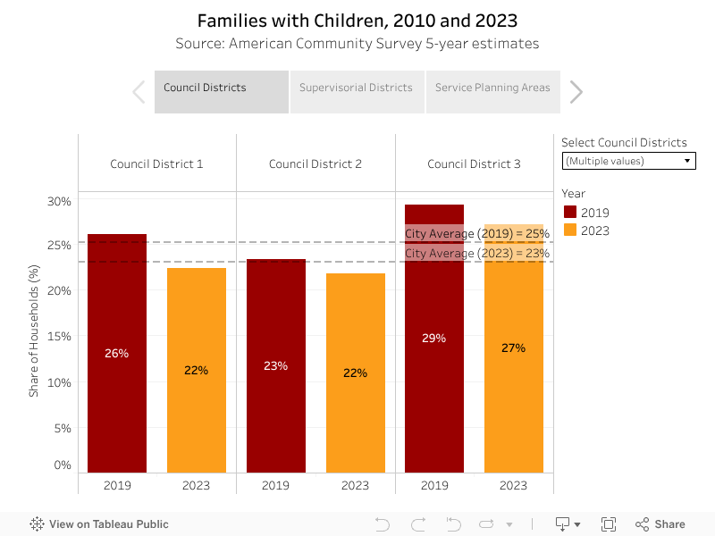
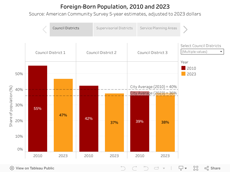
Key Measures for Council Districts, Supervisorial Districts, and Service Planning Areas
Use the boxes at the top of each visualization to view the data at the Council District, Supervisorial District, or Service Planning Area level. Add or remove geographies from the main data pane by using the dropdown menu on the right side of any visualization.