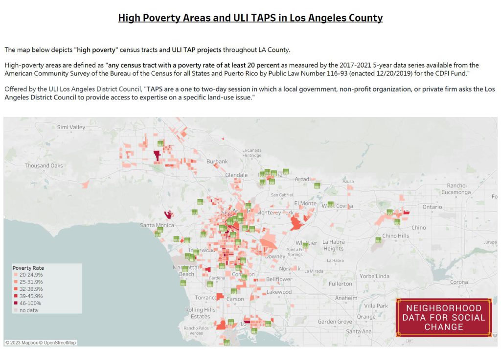
Mapping High Poverty Areas and ULI TAPS in Los Angeles County
NDSC worked with Los Angeles LDC to map high poverty census tracts and locations of Urban Land Institute (ULI) Technical Assistance Panels (TAPs) to help show whether or not these panels were being held in the areas of highest need.


